Three years after the report on sovereign geographic data, which called on the State to fully support the transformation of the National Institute of Geographic and Forestry Information, the public establishment has found a "compass" for all of its activities, particularly in the field of forestry, clarifies its raison d'être and now takes the name " IGN, change of scale ".
Références :
Ten work sites
To give substance to this new momentum, ten projects are highlighted. Some of these projects are already underway and have been put into perspective.IGN continuous national territory observer
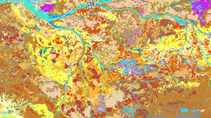
The Institute will refocus and develop its production and development activities on the mapping of the Anthropocene, taking advantage of its capacity for innovation (new reference systems, cross-referencing of data sources, automation of processing by deep learning algorithms, etc.), which will be enhanced by the recruitment and training of new skills, as well as through partnerships with industrial companies and start-ups.- Maps of the Anthropocene: regular publication (every one to three years) of maps on a limited number of major ecological issues, notably the vigor of forests, the evolution of landforms and waterways, soil artificialisation, biodiversity potential, etc., and other themes to be defined in support of public policies; the maps could be enriched by thematic observatories with partners, for example on the forest, and by meetings to share the findings
- A 3D model for the whole of France: acquisition of high density airborne Lidar 2021-2025, gradual availability of open data and work on the use of this data with key sectors (city, forest, agriculture, building, infrastructure, etc.).
- A recruitment and training plan (AI, data science, 3D altimetry, geovisualization, agile development, etc.) based on an attractiveness approach (salary policy, work environment, communication), as well as on the IGN school, ENSG-Geomatics; a managerial and human project for teams that are committed to the institute's ambitions.
IGN, a player in the "digital commons "
If the Institute cannot meet all the needs by itself (e.g. local data, mobility, etc.), it must fully invest in its role of bringing together stakeholders around challenges of common interest.- A "commons place", equivalent to a marketplace for commons, through "calls for commons" to gather interested actors around collective challenges (already identified: streetview, navigable road database), a Geo-commons Factory to develop these themes and other IGN projects with the ecosystem, the Geoplatform, an infrastructure open to commons and public actors for hosting and sharing data.
- A label system for public partners or contributing communities authorized to enrich and update the IGN's "BD France" database independently; authoritative data will remain guaranteed by an agent of the Institute.
- An "IGNfab forum", a forum for exchange with entrepreneurs in the sector, innovation and French tech players, to build shared visions and weave partnerships if necessary; the current IGNfab program to support startups remains and will be enriched with the support of the forum.
IGN cartographer, companion of discoveries and representations
Digital technology increases the potential of the map as a mediation tool; the Institute's history, know-how, scientific influence, and paper and digital maps can be mobilized to reach our fellow citizens, enrich their vision of the territory, and raise awareness among young people, both directly and through a network of alliances to be forged (school audiences, leisure and tourism, heritage, maps as a creative medium).- An alternative plan for smartphones to Google and Apple, which respects the richness of the territory and the freedom of users, to be co-constructed in the Geo-Commons Factory.
- New paper maps: new paper maps to meet the expectations of the French (reconnection to nature, heritage, cycling ...) and maps 1:25,000 fresher and more accessible.
- The "Public Service Cartographer" desk: setting up a support service for all local or national administrations wishing to use maps as a mediation or public policy management tool; this service will enhance the geovisualization and hosting features of the Geoplatform for administrations that so wish.
- Programs for sharing, popularizing science and raising public awareness about cartography and the issues to which it can contribute, embodied in places such as the Musée des Arts et Métiers (heritage), Géoroom in Saint-Mandé (schoolchildren, community stakeholders), and IGN sites in the regions.
The IGN will schedule regular meetings, the first of which is scheduled for the summer of 2022, to report on the progress and implementation of these projects.
A new business model for the IGN and the Geocommons on the agenda
After the opening and the free access to most of the IGN data since January 1st 2021, the IGN is now in " a dynamic of construction of the commons: a set of geographic information databases (production) and digital tools (dissemination) accessible to the largest number"." Unlike what the digital giants do, geo-commons are governed by an open system that guarantees their sharing and their full control and appropriation by a large ecosystem of public and private citizens.
In May 2021, the IGN launched a consultation called " Geocommons, let's move forward together! ", deployed among the actors-users of geodata and all the teams of the IGN. " Because imagining the trajectory of geo-commons cannot be done without listening to users, partners and the internal community of the institute.


